
Welcome to our website. We’re Mattye and Paul. We’ve been making maps together since 2001 and we have a lot of fun doing it. If you need a map, let’s talk.

What we do
Whatever kind of map you need, chances are we’ve done something like it. We’ve made maps as large as 139” W x 94.5” H. We’ve made small, folded brochures and maps for kiosks. We’ve produced 1:500,000 scale wall maps for Oregon and Washington, and made hundreds if not thousands of maps for planning documents. We planned, designed, and produce a multi-state recreation map series. Our maps made at congressional request depicting a proposed wilderness, wild and scenic river, or some other special designation have been displayed during debate in the United States Senate and House of Representatives. Is the need for a digital product? We’re able to deliver geospatial PDFs or image files. We really have done it all when it comes to designing and producing cartographic products. And we really do love it.
Our experience includes the ESRI suite of software, and we can access spatial data from public AGOL sites. We’ve used QGIS as well. Adobe Illustrator is our workhorse for map design, but we also work with InDesign and Photoshop. We utilize the Avenza plug-in MAPublisher to retain spatial and attribute information in our graphic products.
Just fill out the contact form at the bottom of the page and we can get the conversation started.
A few of Mattye’s maps
-
![]()
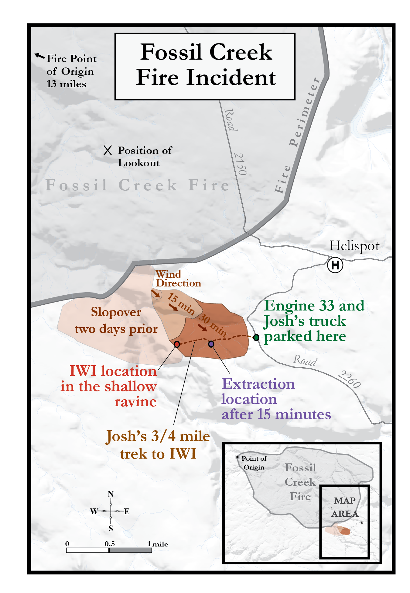
Fossil Creek Fire
This example of my work comes from my time working in fire, where I met wonderful coworkers and had the opportunity to create a map for a friend’s upcoming book. She is a fabulous author, and this project allowed me to blend enjoyment with purpose, designing a map that emphasizes clarity, flow, and detail to help readers easily understand the layout of the area during an intense scene in the story.
-
![]()
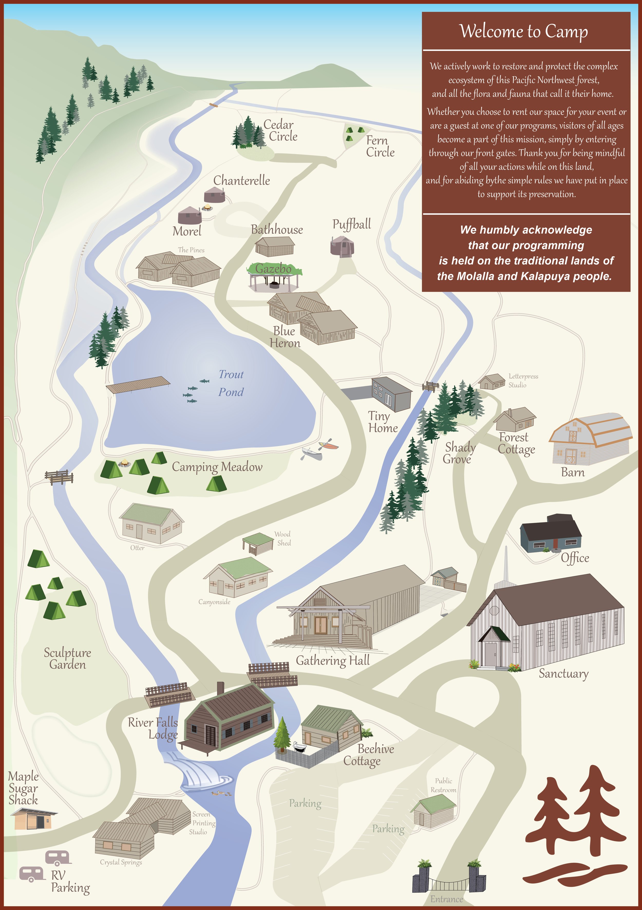
Camp Colton
This second example is a map of a place that is especially near and dear to my heart. Camp Colton is a beautiful space filled with wonderful people, and I wanted the map to reflect that sense of warmth and care. It’s a place worth visiting, where the comfort of glamping meets the beauty of the Pacific Northwest, with diverse trees, trails, ponds, and waterfalls throughout the camp.
-
![]()
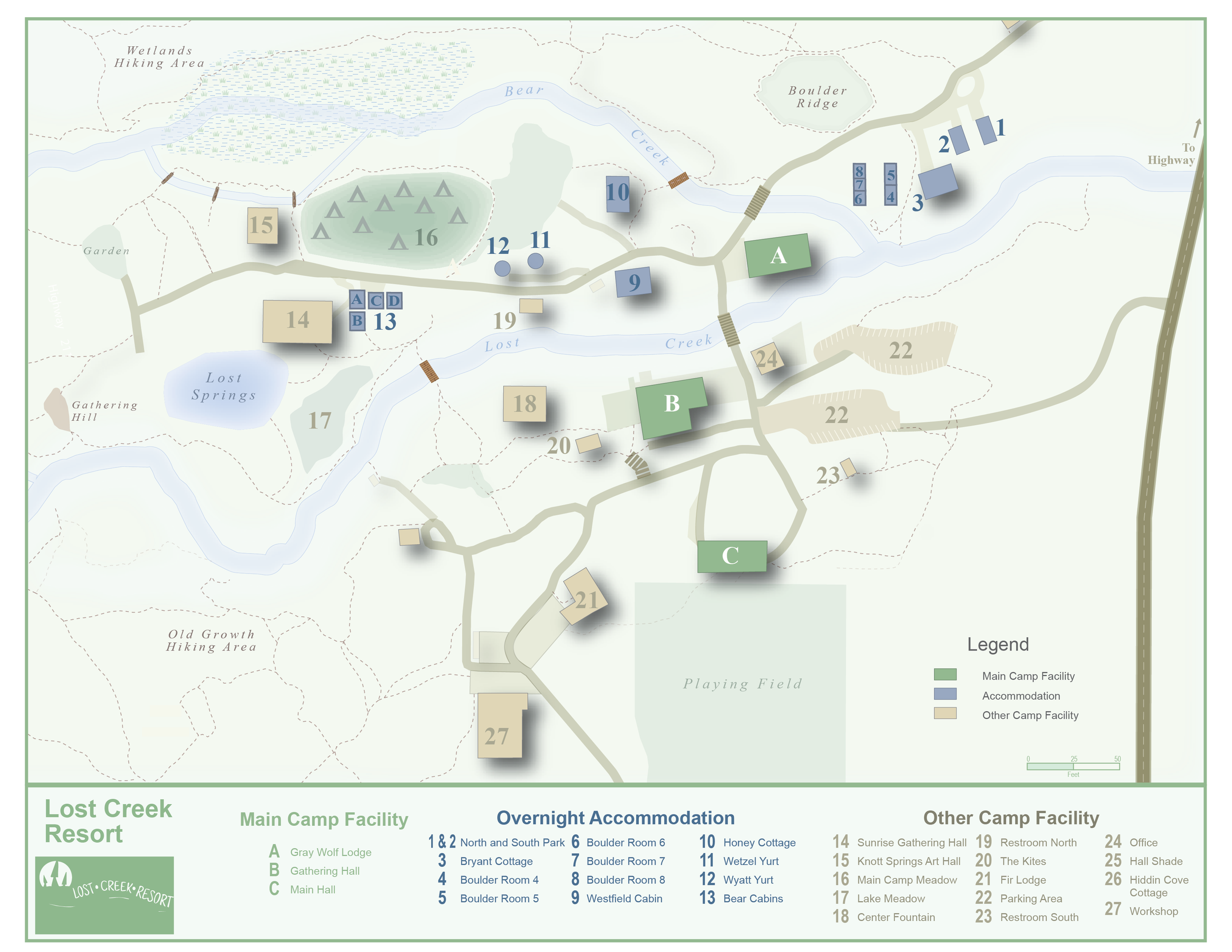
Lost Creek Resort
A simple map showing the layout of a resort.
A few of Paul’s maps
-
![]()
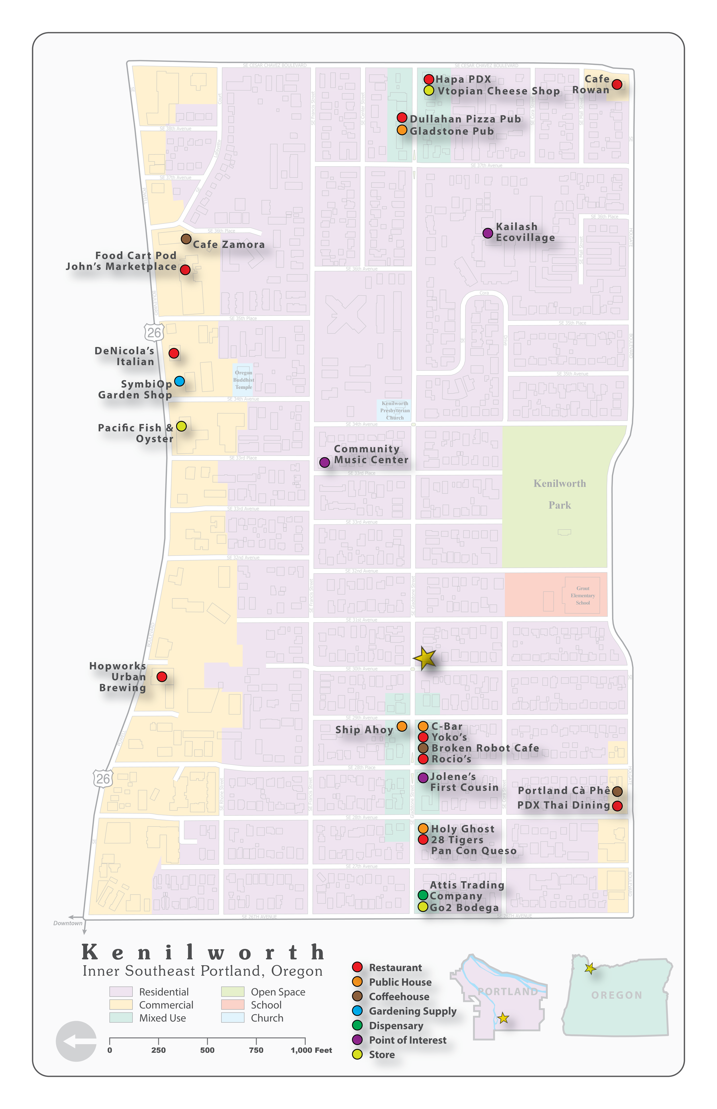
Kenilworth
When a place has meaning to me, I like to make a map of it. This is my neighborhood, where I have lived over half my life. It’s a bustling place with many restaurants and bars that I know well, so I enjoy seeing all of that depicted on a map. It’s home.
-
![]()
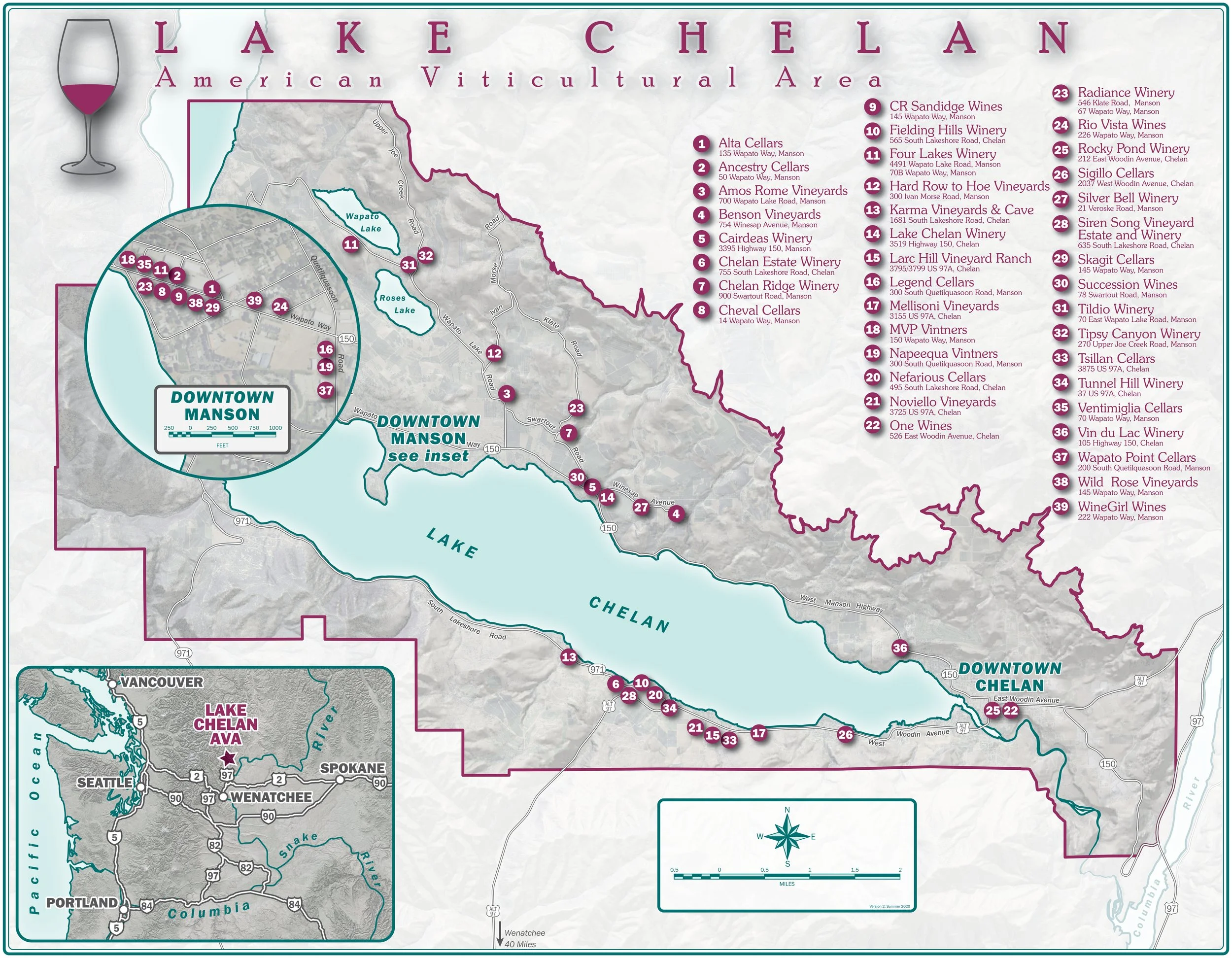
Lake Chelan American Viticultural Area
My first wife, Margie, died in 2022. Lake Chelan was her special place, and we made an annual pilgrimage there so she could swim in the lake. Margie lived there as a young woman, working in the apple orchards, many of which have been replaced by vineyards, which we loved to visit. I used this map to do some bartering for bottles.
-
![]()
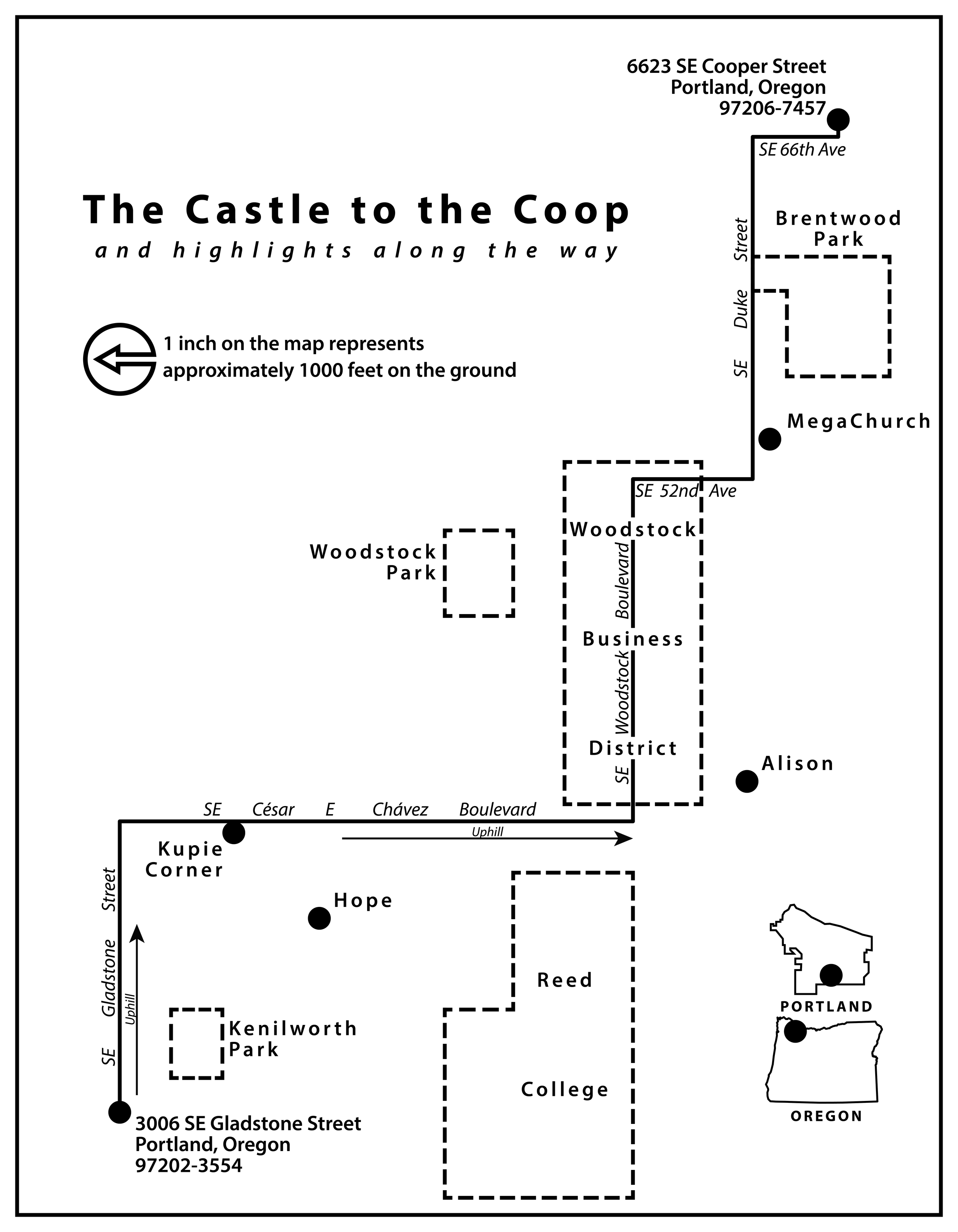
The Castle to the Coop
This is a simple, black and white cartogram that is also remarkably accurate geographically. It depicts a route that I travel often, going from my home to where my son and grandson live. I wanted a simple, stripped down, un-decorative look to this map, leaving off a lot of major locations to focus on the places that have meaning to me.
-
![]()
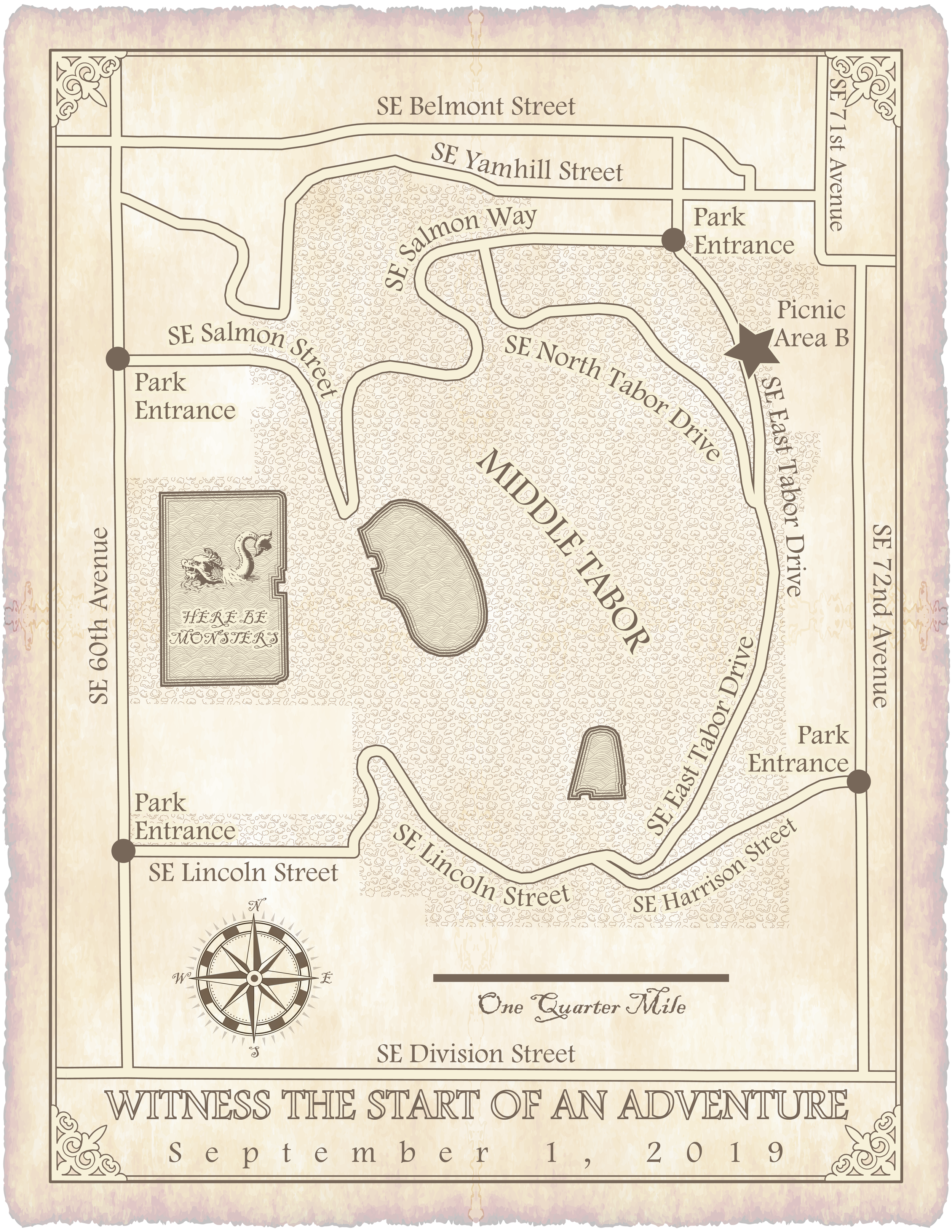
Julia's Wedding
This map was made for my niece’s wedding, which had a LOTR theme. I used a limited color palette and LOTS of pattern swatches. I particularly enjoy the idea of a sea monster in Reservoir 6. Our side of the family was supposed to dress as elves, so we all wore pointy ears. I showed up with Vulcan ears, which are apparently different. Who knew?
-
![]()
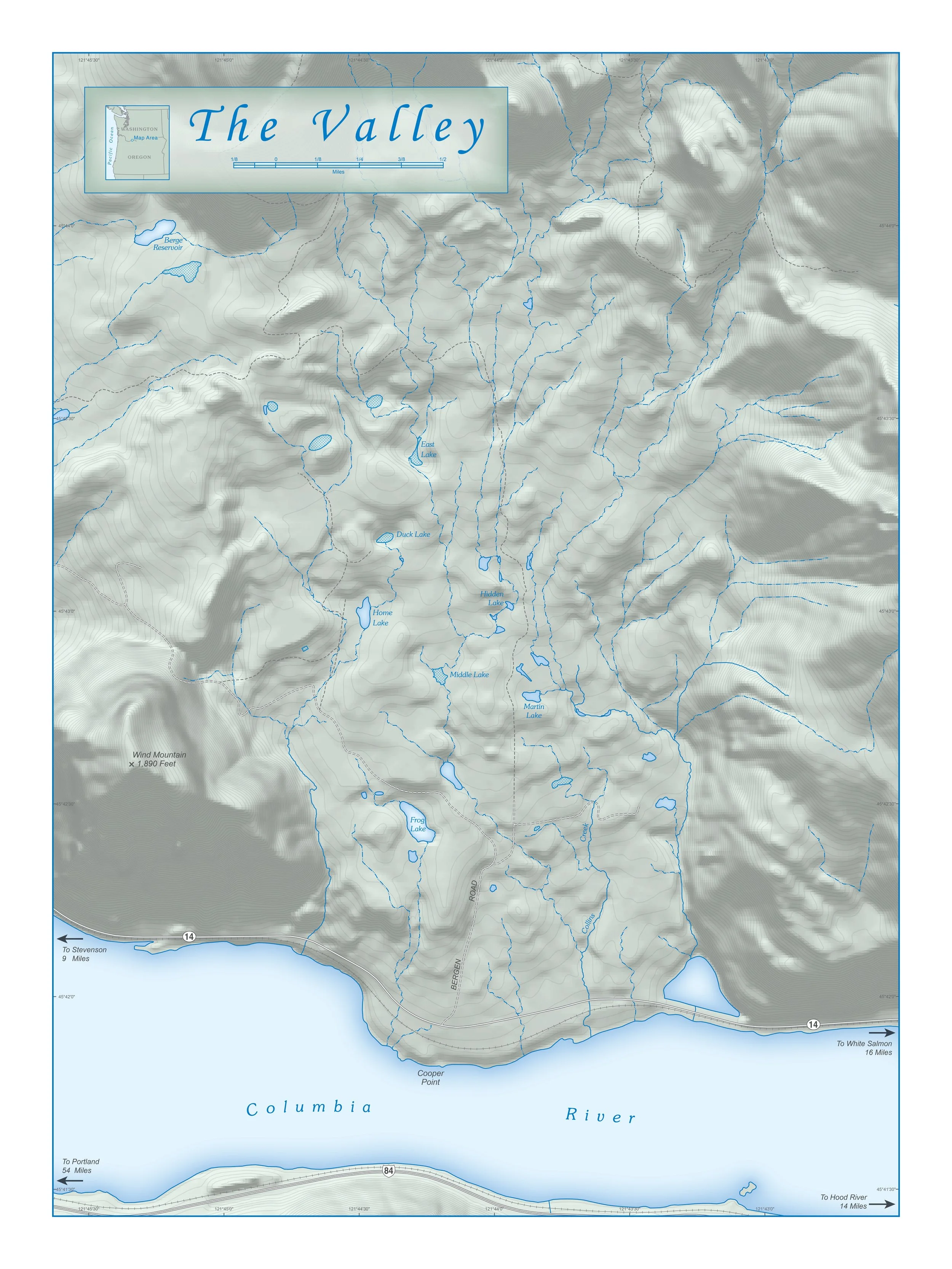
The Valley
The Columbia River Gorge is near and dear to my wife’s heart, in particular the area she calls “my valley” between Dog Mountain and Wind Mountain on the Washington side. Lee Lynn is a wetlands scientist and knows these lakes and streams well. Of course, she says, the hydrography data is all wrong.
-
![]()
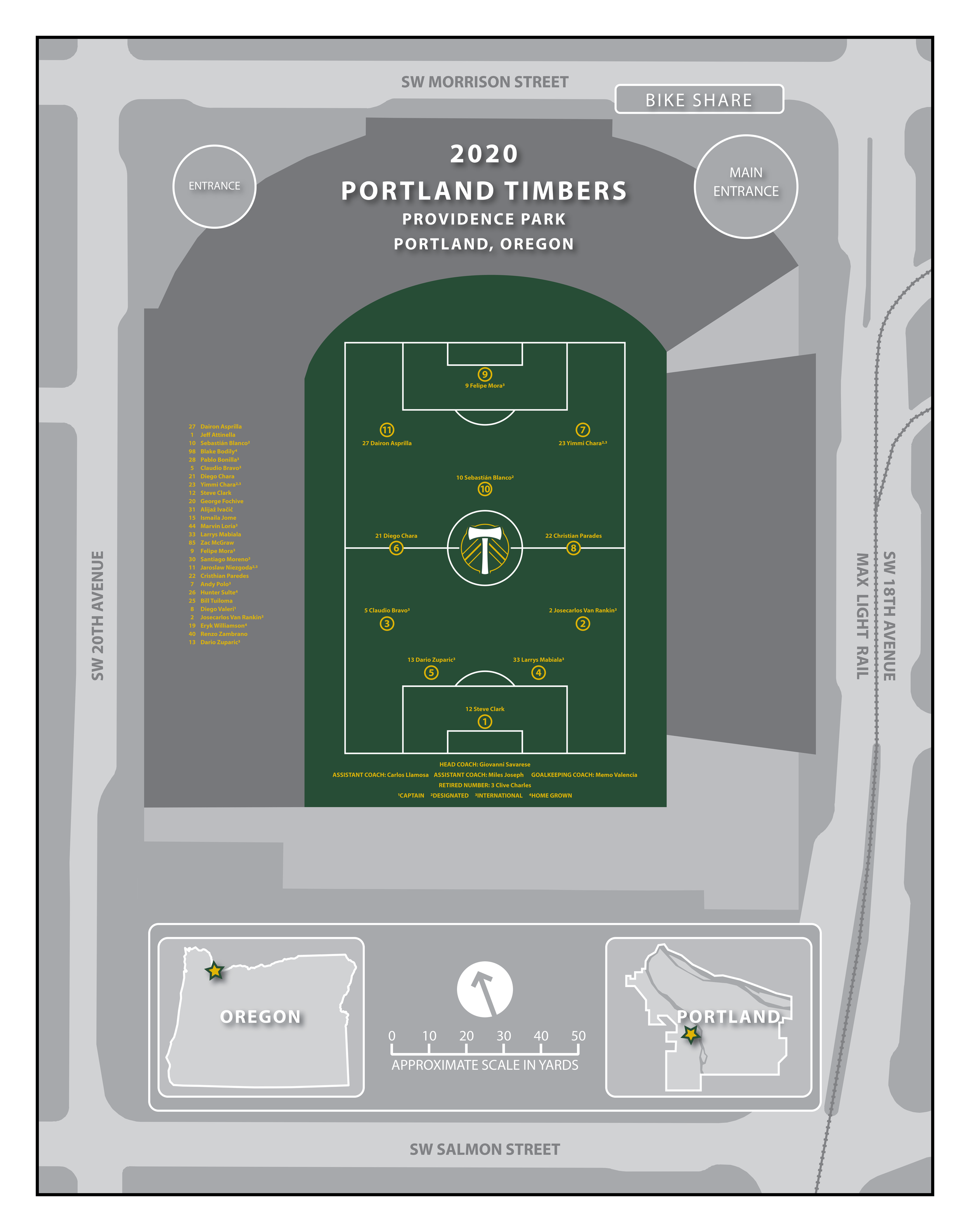
The 2020 Timbers
In 2020 I was pondering a graphic way to present the roster of Portland’s Major League Soccer team, the Timbers, and hit upon the idea of making a map. I like the idea that the approximate locations of the players on the field are recorded in the georeferenced file.
-
![]()
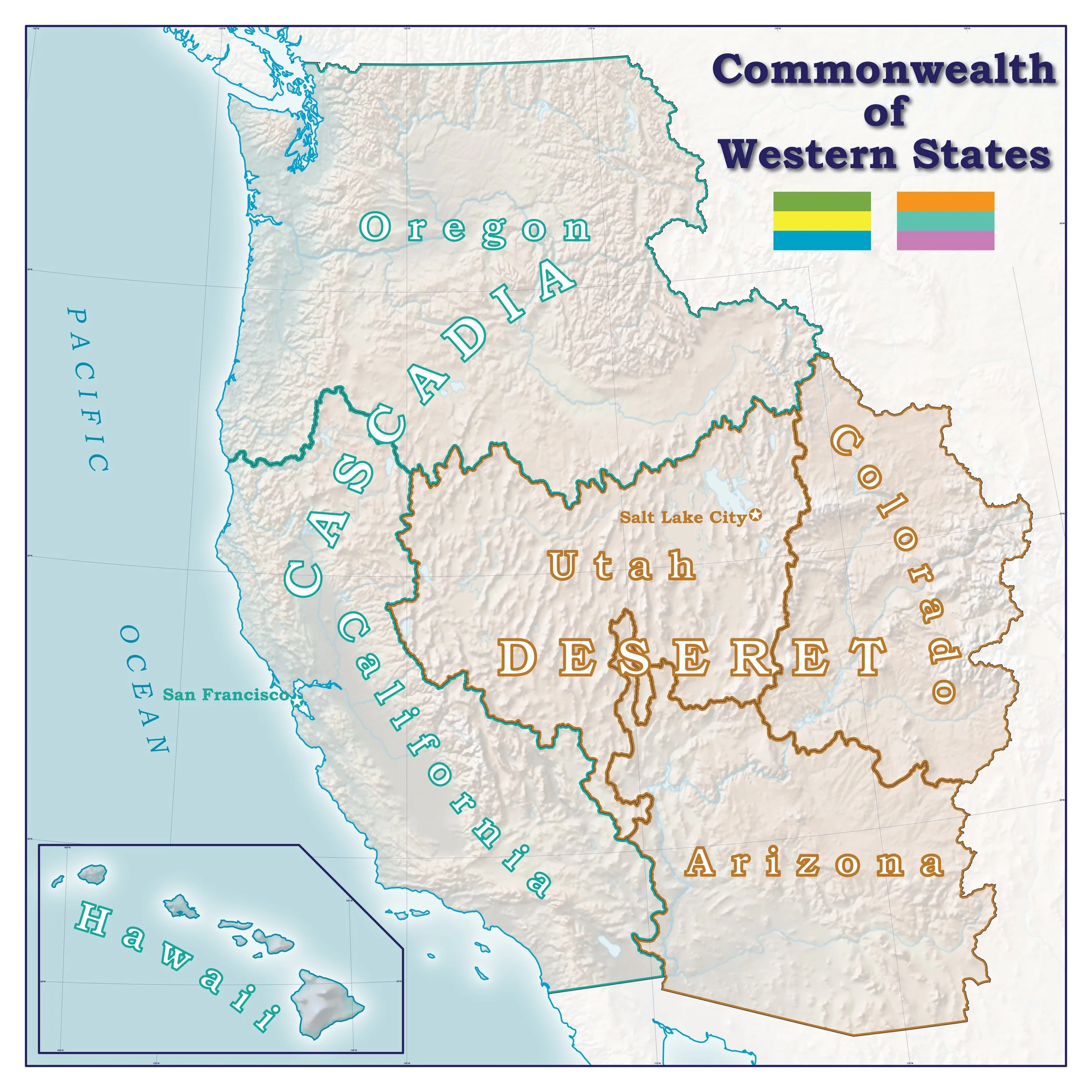
Commonwealth of Western States
Occasionally I engage in secessionist fantasies, and when I do I make a map.
-
![]()
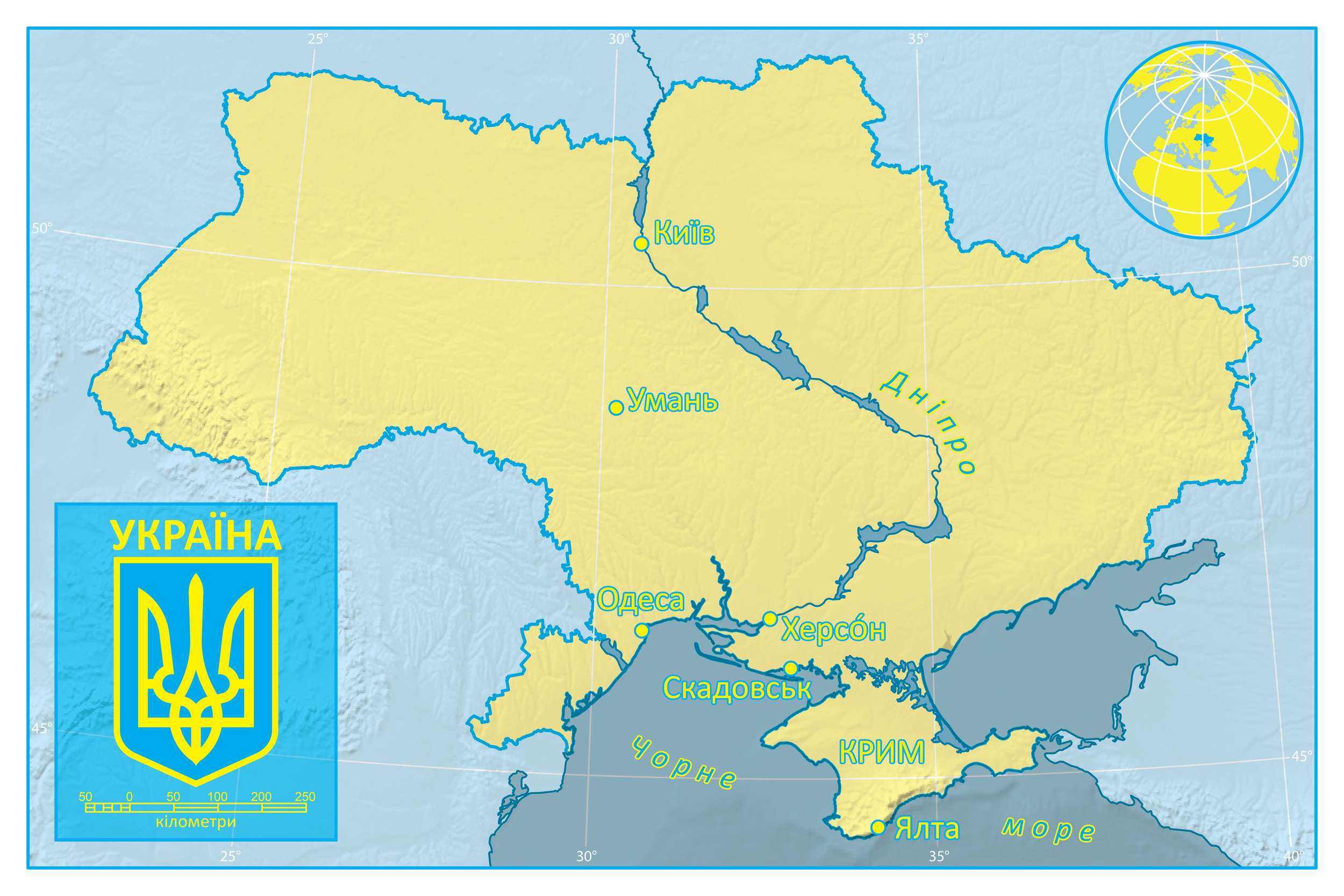
Ukraine
I have friends and family in this beautiful, historic nation, and I’ve traveled there twice, in 2007 and 2008. This map is not intended as a base map of the country but rather a personal record of the locations I visited and have memories of. The news has not been good for this place where we were treated with such warmth. Things were rough back then, I can only imagine what it’s like now.
-
![]()
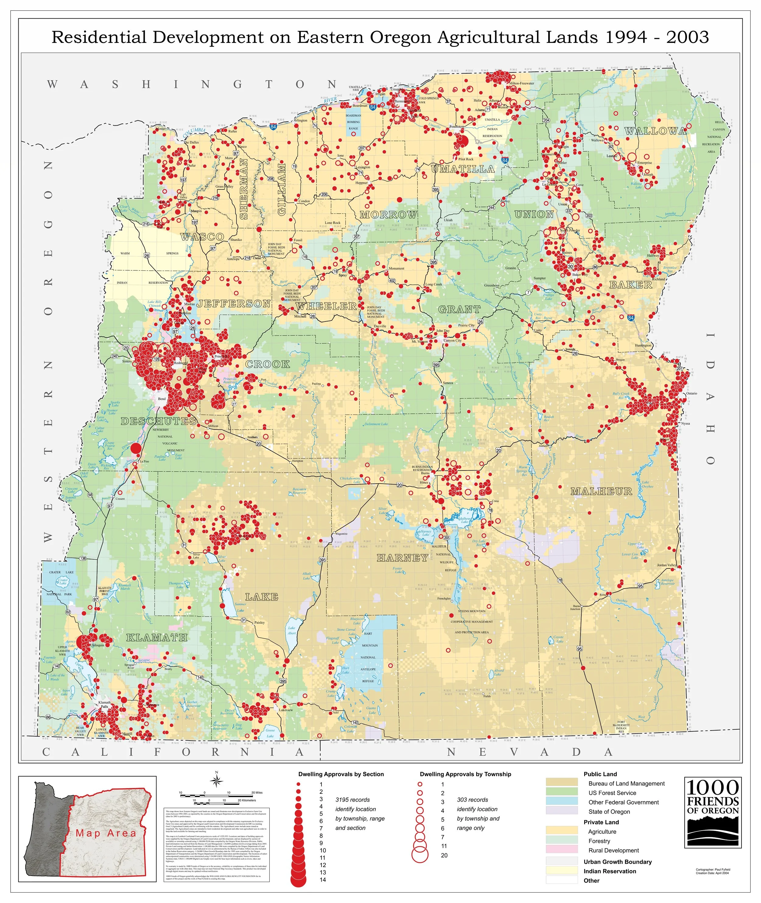
Too Many Homes on the Range
The land use watchdog group 1000 Friends of Oregon asked me to make some maps for their 2005 report “Too Many Homes on the Range,” examining the overdevelopment of farmland in Eastern Oregon. This map was made for a public meeting accompanying the release of that report. The spatial data was generated from a spreadsheet listing the PLSS location of the dwelling approvals.
-
![]()
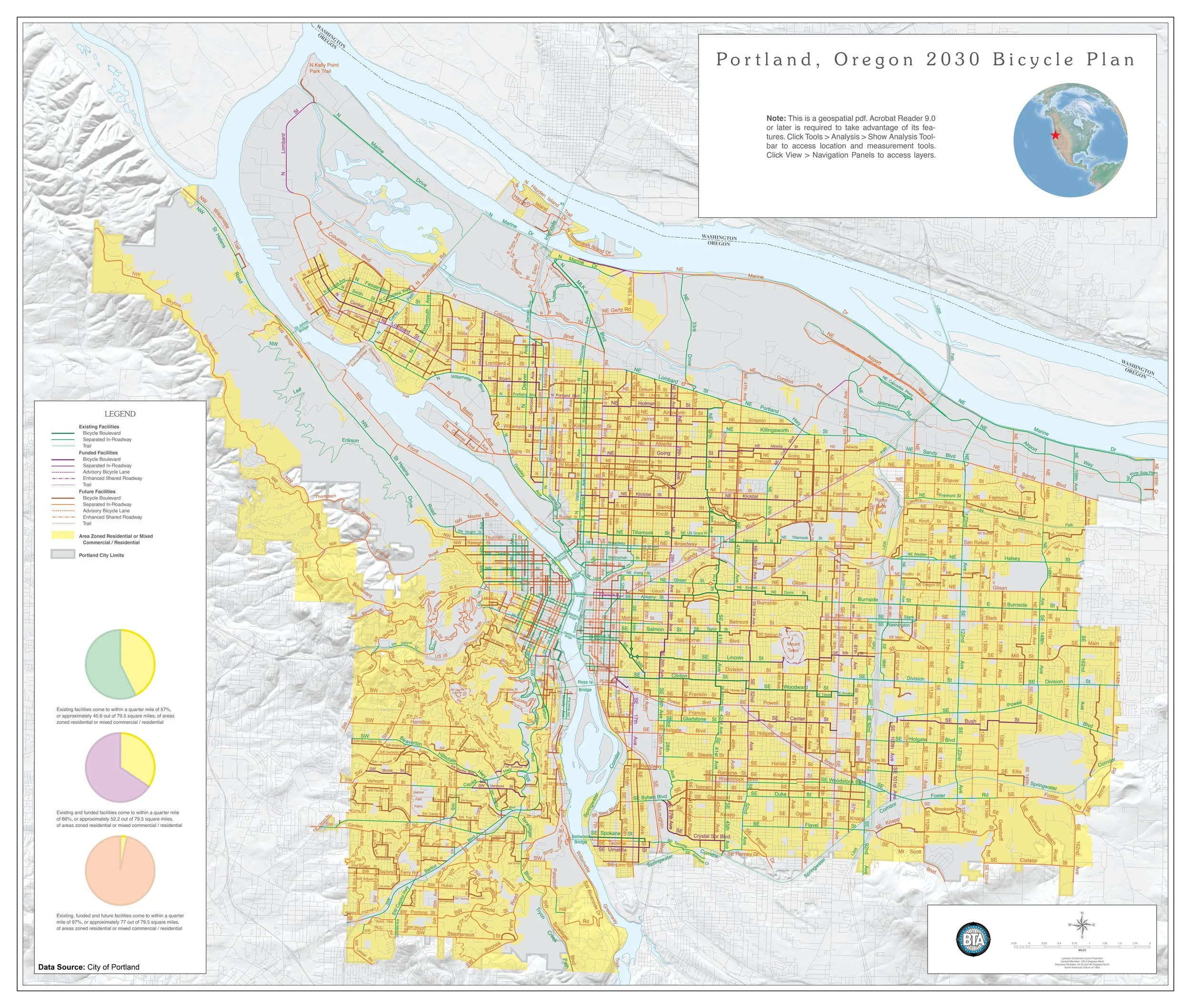
2030 Portland Bicycle Plan
Another of the organizations I’ve done volunteer work for is the Bicycle Transportation Alliance (now renamed The Street Trust), an active transportation advocacy group here in Portland. In 2010 I was asked to create a map of the city’s 2030 bicycle plan. This was served on their website as a geospatial PDF (hence the note by the title, which obviously does not apply to the file you’re viewing).
-
![]()
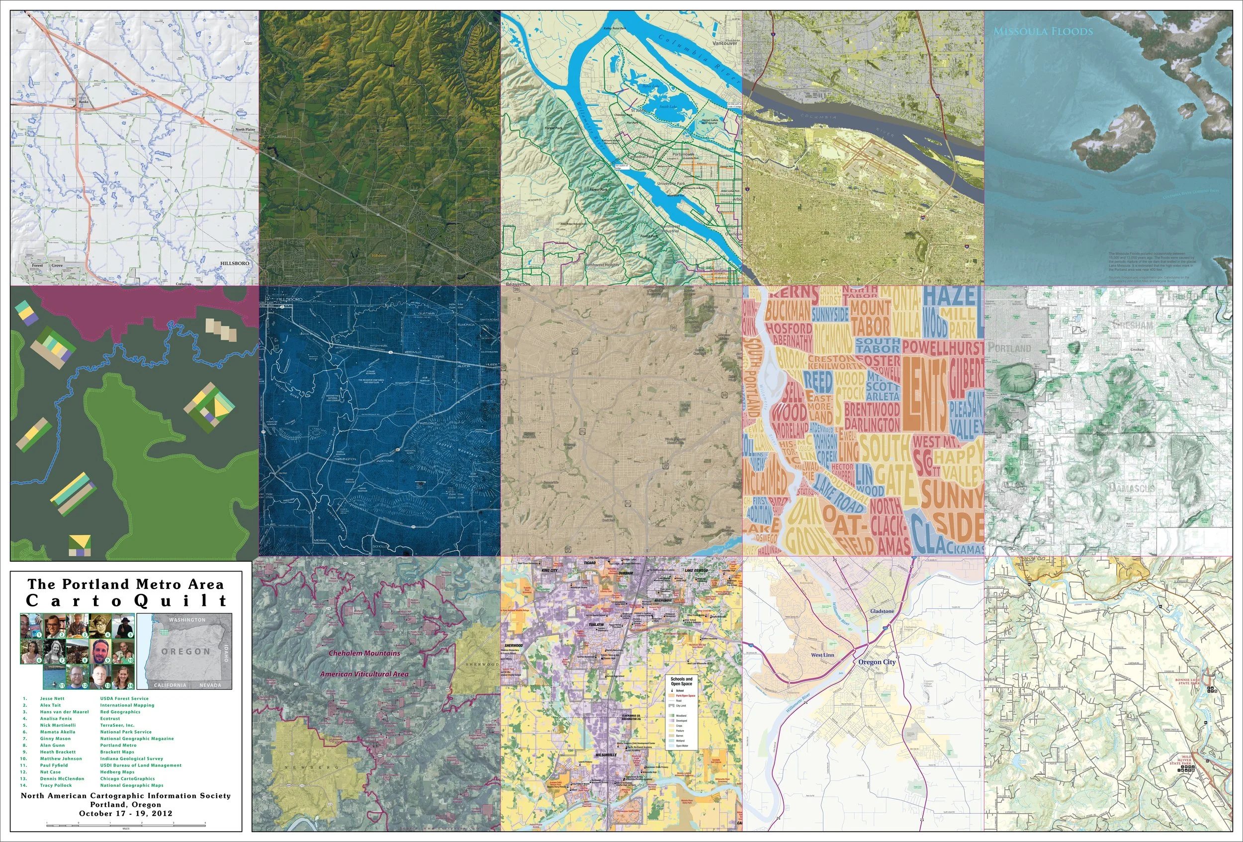
2012 NACIS Map Quilt
When the North American Cartographic Information Society conference was held here in Portland in 2012, we were on the planning committee. The group had this idea to create a map of the city as a patchwork- a carto quilt- and invite cartographers to map their panel in any way they saw fit. No data provided, no rules given. The final product would then be included in the conference’s poster gallery. I laid out the design with an extent based on Portland’s urban growth boundary and a scale based on the size of the plotter available to me. I put the thing together and designed the title panel, as well as one of the map panels. I’m proud to say this idea has caught on and continues as an annual NACIS tradition to this day.
-
![]()
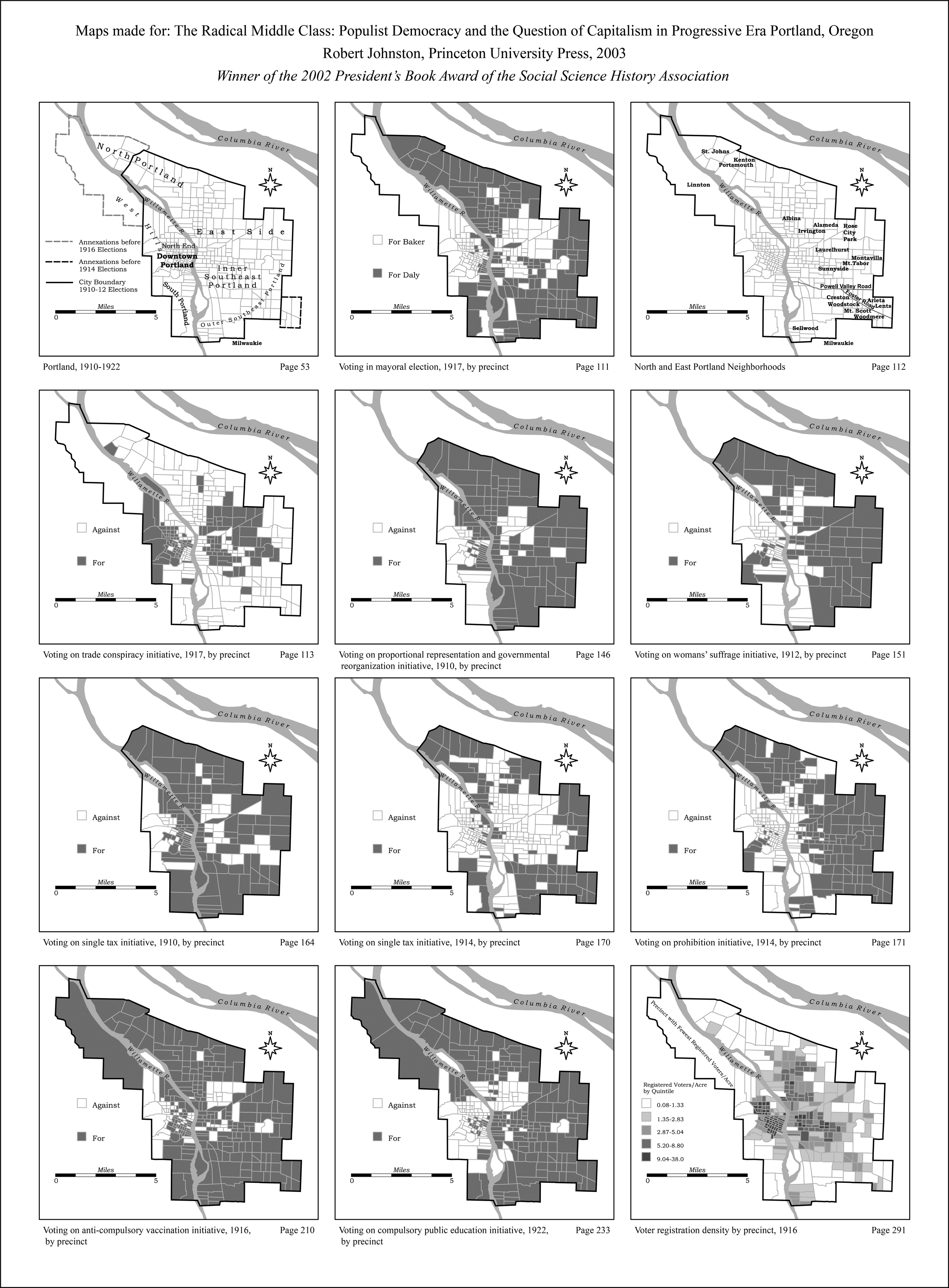
The Radical Middle Class
My first cartography “job” (I didn’t get paid) and my first published maps were for this historical examination of Portland elections 1910-1922. My graduate advisor at Portland State, Joe Poracsky, put me in touch with Portland native and Yale University professor Robert Johnston, who was writing his book “The Radical Middle Class: Populist Democracy and the Question of Capitalism in Progressive Era Portland, Oregon,” published in 2003. For these maps, I researched and created two spatial datasets for the precincts (which changed dramatically in 1916) then attributed them based on tabular data Robert provided. I used ArcView 3.2, CorelDRAW, and exported EPS files for the final maps. How times have changed.
About Mattye
My home, in close-in NE Portland, is an open place where friends and relatives always feel welcome. After creating a beautiful community raising my two adorable children here, I recently married my husband, Steve, and now have a large blended family, with five adult kids between us. It’s a busy, bustling place, and I thrive on the chaos.
My father worked for the US Fish and Wildlife Service, and I grew up on the wildlife refuges that he helped manage, including the Malheur Wildlife Refuge in SE Oregon during my high school years. Being surrounded by wide-open landscapes shaped me, and I’ve been happiest outdoors ever since. I grab any chance to travel, explore, and try something new, recent favorites include Thailand and Costa Rica, and I’m usually plotting my next adventure before I’ve even unpacked from the last one.
My love of travel and the outdoors is a big part of why I’m drawn to maps. They show what a place offers, how to reach it, and how to explore it. Making maps lets me help people enjoy the places they visit and get the most out of their experiences. Honestly, I adore this work because cartography is the perfect mix of science and art where I get to dive into data, play with design, and create something useful.
I came to Portland in 1996, college-bound and curious, earned my degree in Geography in the heart of the city at Portland State University, and it was here that I discovered cartography. I’ve loved both the work and this city for my entire adult life. Paul and I first met when I began my career as a cartographer at the Bureau of Land Management just out of college. We’ve worked together ever since as part of the small, but mighty mapping team, making a wide variety of thousands of maps for public lands. Now I’m thrilled to bring that experience to a wider circle through Mattye and Paul, Cartographers.
Recently, I followed through on my long-term desire to contribute my skills in a larger setting, working on the interagency fire teams doing GIS and mapping support during the summer fire season. The work is grueling, with two week stretches working sixteen-hour days and sleeping in a tent in dusty, smoky conditions, all over the western US. Every day begins with a one-hour deadline to produce a current status map for the morning briefings. After many years of making polished maps using Adobe software, I had to quickly adjust and expand my GIS skills to an intense new workflow, allowing me to expand the type of products I can create through entirely new processes.
Paul and I look forward to working with you on your mapping projects!
About Paul
A native New Englander, I moved to Portland in the early 1980s after coming out to visit my older sister, who was attending Reed College. I’ve settled in nicely here, living in inner SE Portland for most of that time. Married for over three decades, then widowed for a few years, I am recently re-married to my wife, Lee Lynn. We enjoy all the Portland things- walking and biking around the neighborhood, going out to dinner or cooking at home, gardening, foraging for chanterelles or huckleberries, day trips to the coast, gorge, or wine country, going to Pickles games. My grandson Matthew spends quite a bit of time with us and is a huge part of our lives.
My interest in maps came early, mostly from exposure to National Geographic and the Raisz Landform maps advertised in my older brother’s copy of the Whole Earth Catalog. Later, the visual arts became my focus, which eventually led to a bachelor’s degree in art from Portland State University in 1988. I spent the 1990s showing my woodcut prints in galleries in NW Portland’s Pearl District while working nearby in a high-end picture frame shop. We had a small gallery in the shop, displaying antique prints to demonstrate our framing designs.
I began collecting prints from the dealers we worked with- woodcuts, engravings, lithographs- but soon my interest narrowed to old printed maps. When I was ready to go back to school in 1998, I decided that becoming a cartographer was my goal and I pursued a master’s degree in geography at PSU. While at PSU I taught the GIS labs, and later was selected for a student internship in the Bureau of Land Management Oregon State Office in Portland, starting in 2001. I was brought on permanently as a Series 1370 Cartographer when I finished grad school in 2003.
Starting in 2012, I returned to PSU part-time as an Adjunct Professor. I designed, and for 10 years taught, a graduate-level cartography course, GEOG 485/585, Map Design and Production. Last I heard, that class is still being taught, by one of my former students.
I knew Mattye during our time at PSU, mostly through mutual friends, but we really began working closely together during our many years at the BLM. Our small team works on maps of all kinds, including our flagship product, the Pacific Northwest Recreation Map Series, along with recreation brochures and kiosks, complex maps for planning documents, and congressional requests, high-priority maps required in very short time frames. Mattye and I formed a trust and partnership that we decided to extend beyond the BLM by launching our own map design and production business.
For many years, our colleagues at the BLM have known: if you need a map, you talk to the cartographers, Mattye and Paul. Now, anybody who needs a professional, quality map can do the same: contact Mattye and Paul, Cartographers.